MAPS
Printable pdf map
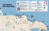
The Cliff Walk
Newport’s world famous Cliff Walk, a public access walk and trail along the majestic Atlantic Ocean shoreline. Cliff Walk is one of New England’s most popular attractions – the only National Recreational Trail within a National Historic District in the United States. The Walk not only offers magnificent views high over the water, but glimpses of many historic “Gilded Age” mansions with their lawns spilling majestically out to the Walk. As you travel along the Walk, note the 16 trail markers, each of which features a QR code that your smart phone can scan for more information on that particular site. A tiny URL link can also be entered.
Printable pdf map
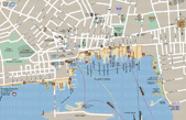
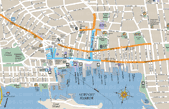
Newport Harbor Walk
Newport’s Harbor Walk is a community effort in which neighborhood groups, residents, the Newport city’s park division, businesses, and a variety of non-profit public interest groups are working together on this long term goal to establish this walk along Newport’s waterfront.
Printable pdf map
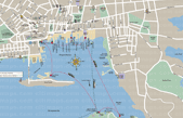
Newport Harbor Walk with Fort Adams
Newport’s Harbor Walk is a community effort in which neighborhood groups, residents, the Newport city’s park division, businesses, and a variety of non-profit public interest groups are working together on this long term goal to establish this walk along Newport’s waterfront. Included is the Fort Adams walk.
Printable pdf map
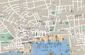
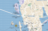
Newport Harbor
Full view of Newport Harbor. This map will show you where to go while in Newport. Most of the area attractions and the historic Mansions are shown here.
Printable pdf map
Newport Harbor Parking Map
Full view of Newport Harbor. This map will show you where to park while in Downtown Newport.
Printable pdf map
Downtown Jamestown
A View of the local streets and buildings in Downtownin Jamestown.
Printable pdf map
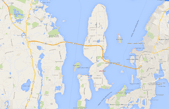
Jamestown
View of Jamestown from the Jamestown Bridge to Fort Wetherill State Park.

Printable pdf map
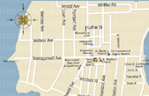
Bowen’s and Bannister’s Wharf
Bannister’s & Bowen’s Wharfs map is a layout of both wharfs which shows all major buildings and parking areas.
Printable pdf map
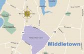
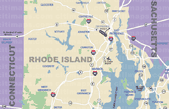
Rhode Island
Rhode Island map is a full view of Rhode Island from Connecticut to Massachusetts. Including most major highways.